Grounding - Passenger vessel "HANSEATIC"
Simpson Strait, Northwest Territories
The Transportation Safety Board of Canada (TSB) investigated this occurrence for the purpose of advancing transportation safety. It is not the function of the Board to assign fault or determine civil or criminal liability. This report is not created for use in the context of legal, disciplinary or other proceedings. See Ownership and use of content. Masculine pronouns and position titles may be used to signify all genders to comply with the Canadian Transportation Accident Investigation and Safety Board Act (S.C. 1989, c. 3).
Summary
While on passage from Gjoa Haven to Resolute Bay, the "HANSEATIC" ran aground in Simpson Strait. The weather was fine and clear and the vessel was being navigated visually, by reference to shore ranges, and by radar. The passage plan was disrupted when it was assumed that a buoy, which had been left in the strait from the previous navigation season, was marking a shoal. The buoy had been moved out of position by ice.
The Board determined that the "HANSEATIC" grounded because the bridge team did not strictly adhere to the plan that had been prepared for navigating the vessel through the strait. Relying on a navigation buoy left in the strait from the previous navigation season contributed to the grounding.
Factual Information
1.1 Particulars of the Vessel
| Name | "HANSEATIC" |
|---|---|
| Official number | 720407 |
| Port of registry | Nassau, Bahamas |
| Flag | Bahamas |
| Type | Passenger |
| Gross TonsFootnote 1 | 8,378 |
| Length | 122.80 m |
| Draught | 4.8 m (max) |
| Built | 1991, Rauma, Finland |
| Propulsion | Two 2,940 kWFootnote 2 diesel engines, driving two controllable-pitch propellers |
| Owners | Bunnys Adventure & Cruise Shipping Co., Hamburg, Germany |
| Passengers | 149 |
| Crew | 110 |
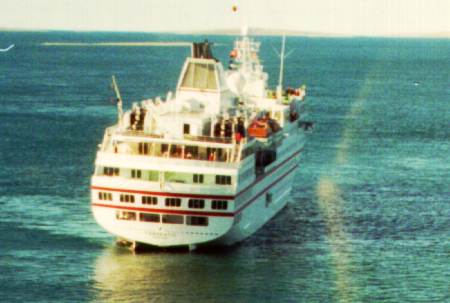
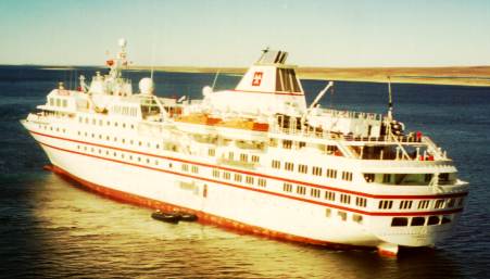
1.1.1 Description of the Vessel
The "HANSEATIC" is of typical passenger ship construction with the superstructure extending the entire length of the vessel abaft a short foredeck. The navigation bridge is situated at the forward end of the superstructure.
The navigation bridge is of modern design. The control console is situated forward in the wheel-house. There are three radars in the wheel-house, one to each side and one near the centerline.
The view forward is unobstructed but, because of the superstructure, it is not possible to see astern from inside the wheel-house. To improve visibility astern, the bridge wings extend outside the superstructure. A manoeuvring console with a gyro-repeater is fitted on each wing.
The "HANSEATIC" is an up-market passenger vessel which, since 1993, has specialized in what have been variously described in the maritime press as expedition cruises or adventure cruises. Where no port facilities exist, the vessel's outfit of small boats allows passengers to disembark for tours ashore.
The vessel's hull is ice-strengthened.
1.2 History of the Voyage
On 29 August 1996, the "HANSEATIC" was in the eleventh day of a Northwest Passage cruise which had started in Nome, Alaska, and was to have terminated in Greenland. The cruise had taken the vessel to several communities in Alaska, Yukon and the Northwest Territories.
On the morning of 29 August, the "HANSEATIC" made an eastbound passage in Simpson Strait to the village of Gjoa Haven where she was to anchor for part of the day, while passengers went ashore for a tour of the village. During the trip, several buoys were unexpectedly found in the strait. The master had not anticipated seeing any buoys in the strait because the Arctic Canada Traffic System (NORDREG CANADA) had advised him that the buoys for Simpson Strait were still on board the CCGS "SIR WILFRID LAURIER", as the ice breaker had not yet had an opportunity to position them. The majority of the range markers for the various legs of the inbound passage were positioned ahead of the vessel and the passage was straightforward and uneventful. Little attention was paid to the buoys or whether they were in their charted positions.
The "HANSEATIC" left Gjoa Haven in the afternoon of 29 August for Resolute Bay. Initially, the voyage to Resolute required that the "HANSEATIC" retrace her morning passage through Simpson Strait, in a westerly direction. The route involves many alterations of course and, as on the inward passage, the master had the conduct of the vessel. With him on the bridge were a helmsman and the chief officer who assisted with the navigation. The ship, which has an operating speed of 14 knots, was making about 10 knots and no difficulty was experienced with the initial part of the transit. A position taken at 1738,Footnote 3 confirmed that the vessel was proceeding parallel to, and approximately a cable south of, the 288° course line indicated on the chart for the ranges on Eta Island. The vessel was south of the charted course line to avoid a 6.1 metre shoal reported near the track. Once past the shoal, and approximately half way along this leg, the "HANSEATIC" was brought back towards the 288° course line. At 1745, a check of the ship's position by the chief officer showed the vessel abeam of the northwest extremity of Saatuq Island and almost exactly on the 288° course line. The vessel was at this point about half a mile from the next alter-course position, and the chief officer turned his attention to setting up the radar for the next leg.
Meanwhile, the master was monitoring the vessel's position relative to the 288° course line by reference to the Eta Island ranges. Because the ranges were astern of the vessel, and with the helm orders ranging from 290° to 293°, the master had to frequently go out to the starboard wing of the bridge to check the ranges. The master was reportedly keeping the ship on a heading which was increasingly to starboard of the course line to counteract the effect on the vessel of the northwest wind.
As the "HANSEATIC" approached the alter-course position, the master was aware that the ship was north of the ranges, but the sight of a green buoy on the starboard side gave him confidence that she would pass clear of a shoal lying just to the north of the course line. However, the buoy had not been removed at the end of the previous navigation season and the winter ice had moved it about 200 metres to the northeast. Consequently, the "HANSEATIC" did not clear the shoal and ran aground in position 68° 33.75′ N, 097° 32.2′ W.
As the vessel was not considered to be in any danger, during the next few days, while awaiting assistance, passengers were afforded the opportunity to explore adjacent islands, using the ship's boats. On 05 September 1996, with the exception of a few who had requested to be flown home, the passengers were transferred to another vessel to carry on with their Northwest Passage cruise.
Following several unsuccessful attempts, the vessel was finally refloated on 08 September 1996, with the help of the tug "EDGAR KOTOKAK" and the coast guard cutter "NAHIDIK".
1.3 Injuries to Persons
No one was injured as a result of the grounding.
1.4 Damage
Damage was limited to the underwater hull between frames 77 and 126. The shell plating was holed and severely rippled on both sides of the centreline girder but there was no pollution as a result of the occurrence.
1.5 Certification
1.5.1 Vessel
The vessel was certificated, crewed and equipped in accordance with existing regulations.
1.5.2 Vessel's Navigation Personnel
Both the master and the chief officer held qualifications appropriate for the tonnage of the vessel on which they were serving and for the voyage being undertaken.
1.6 Personnel Experience
The master of the "HANSEATIC" had 26 years' experience as master on a wide variety of passenger vessels. Although he had sailed in the Canadian Arctic on several occasions, this was his first voyage through Simpson Strait.
The chief officer of the "HANSEATIC" had 25 years' sea-going experience, 10 as master. He had seven months' experience on board the "HANSEATIC" as chief officer.
1.7 Bridge Team
The master, chief officer and helmsman were on the bridge prior to, and at the time of, the grounding. Although an ice navigator was on board the "HANSEATIC", at this time of year the vessel was permitted to navigate in the Simpson Strait area without his aid, and he was not on the bridge during the passage.
The bridge team was well rested at the time of the occurrence.
1.8 Environmental Information
1.8.1 Weather
The weather was fine and clear with a northwesterly wind of 17 to 21 knots. The sea was calm in the sheltered waters of the strait and the visibility was reported to be about 5 miles. The air temperature was 7C; the sea temperature was 4C.
1.8.2 Tide and Tidal Stream
According to the Sailing Directions - Arctic Canada, Volume I, the average tidal range in Simpson Strait is about 0.6 m. The range for the tidal cycle during which the grounding occurred was calculated to be about 0.5 m. The grounding occurred about four hours after high water.
The Sailing Directions advise that "the tidal stream, from brief and broken observations, is rectilinear, running roughly parallel to the axis of the strait..." They also caution that "...tidal streams up to 4 knots, and up to 7 knots near Eta Island, have been experienced, with marked changes of direction, tide-rips and backeddies around the islets and shoals." On Canadian Hydrographic Service (CHS) chart No. 7735, tide rips are indicated in the area of the grounding.
From an analysis of the information available, the Institute of Marine Sciences in Sidney, B.C., formed the opinion that they "...would not expect there to be a strong deflection of the current from the along-channel direction in the vicinity of the range line..." They concluded that "...currents were unlikely to be a significant factor in carrying the Hanseatic off the range line."
1.9 Navigation of the Vessel
1.9.1 Navigation Equipment
The vessel's navigation equipment was reportedly in satisfactory condition. Two radar sets were being used in the navigation of the vessel and no deficiency was reported.
The Global Positioning System (GPS) was not being used. Positions obtained by GPS in Simpson Strait can be off by as much as one mile, when plotted on the chart. This lack of precision is due to the inaccuracy of geographical coordinates on charts of the area.
1.9.2 Charts and Publications
The marine chart being used by the vessel was the CHS chart No. 7735, Simpson Strait.
Many areas of the Arctic coast are either incompletely or inaccurately charted, or both. The geographical coordinates are not accurate on some charts (including chart No. 7735) but the shore lines and other features on chart No. 7735 are correctly depicted relative to each other. Positions obtained from the radar and by visual means will be accurately represented on the chart.
The Sailing Directions - Arctic Canada, Volumes 1 and 3 are relevant to the area of the occurrence and these publications were on board the "HANSEATIC".
1.9.3 Aids to Navigation
The Sailing Directions advise that the channel through Simpson Strait is marked by beacons, beacon ranges and buoys. The Sailing Directions also advise that the buoys in Simpson Strait are seasonal. However, because the Canadian Coast Guard (CCG) policy is that the operational requirement for ice-breakers takes precedence over the removal of the buoys in the strait, the buoys are not always removed at the end of the shipping season. Each season, the CCG does not consider the strait to be buoyed until a Notice to Shipping is issued, specifically stating that the buoys for the area have been deployed. Such a Notice to Shipping had not been issued at the time of the occurrence. Although the buoys are built to be expendable, some of the buoys are not destroyed during the winter and remain afloat in the strait or grounded on adjacent beaches. Buoys that remain afloat are almost invariably displaced from their charted positions. While the buoy that marked the shoal on which the "HANSEATIC" grounded had been moved about 200 metres to the northeast, the buoy that marked the shoal on the other side of the channel was found some 1,300 metres to the west of its charted position.
A stretch of some 20 miles of the navigation channel depicted on CHS chart No. 7735 comprises eleven legs, eight of which are defined by a set of shore range markers. Persons experienced in navigating in the Arctic advise that, because some of the range markers are built on low islands, they may be pushed out of position by the ice and mariners must be cautious when using them. Six of the eight sets of range markers are ahead for an eastbound vessel.
The 108°-288° range markers on Eta Island were checked after the "HANSEATIC" grounding and were found to be in their correct positions.
All aids to navigation in Simpson Strait are unlit.
1.9.4 Cautionary Notes Regarding Buoyage
Canadian publications relevant to a passage through Simpson Strait contain several warnings against relying on buoys in the area.
A note on chart No. 7735 states that "the channel leading through Simpson Strait is marked by seasonal buoys which are liable to be displaced by ice." All Sailing Directions published by the Department of Fisheries and Oceans (DFO) advise that "mariners should not rely on buoys being in their charted positions at all times. Buoys should be regarded as warning markers and . . . Masters should always navigate by bearings or angles on fixed shore objects." The Sailing Directions - Arctic Canada, Volume 1 also warns that "buoys laid in Arctic waters must be regarded merely as temporary and very unreliable aids to navigation . . . and they are always liable to be carried away by the movement of ice . . ." The Sailing Directions - Arctic Canada, Volume 3 advises that "buoys in Simpson Strait are seasonal and consist of four oil drums welded together end-to-end and painted red or green. Some years, because of ice conditions, it is not possible to lay the buoys, and since buoys in these ice-strewn waters cannot be depended upon to remain in their correct positions for very long, little reliance can be placed on them."
1.10 Passage Planning and Bridge Resource Management
The master and the chief officer had been involved in the planning of the passage. The Sailing Directions describe the passage through Simpson Strait as probably "the greatest navigational hazard in the whole mainland passage . . . because of numerous shoals, narrow channels and strong tidal streams". This publication also states that "numerous dangerous shoals . . . lie close to the channel and it is probable that these are altered considerably by ice action each season."
In describing the topography, the Sailing Directions advise that "on the north side of Simpson Strait, the . . . coast presents a low, regular and rather featureless appearance, with no distinctive landmarks" while the south ". . . coast is somewhat higher than the north coast but its overall elevation is moderate gradually rising to distant hills . . . The islands in Simpson Strait consist mainly of stones and large boulders, and . . . tend to blend in with each other and with the adjacent shoreline."
For the passage in Simpson Strait, the master had the conduct of the ship and the chief officer was assisting by plotting the vessel's position. In the parts of the strait where the alignment of the channel is indicated by shore leading marks (ranges), any lateral displacement of the vessel from the alignment could be quickly detected by the master. To indicate the vessel's progress along the alignment of the channel, radar distances and bearings of the shore were to be obtained and plotted by the chief officer. No supplementary parallel indexing was being used when the vessel was on the Eta Island range markers, but parallel indexing was to be used on the next leg. With the vessel proceeding westbound on these two legs, the range markers were astern. When the vessel was proceeding on the Eta Island course, the radar distance ranges used varied with the application.
1.11 Ice Navigator
According to the Arctic Shipping Pollution Prevention Regulations, the "HANSEATIC" was not required to carry an ice navigator, although an ice navigator had been on board since the vessel departed Nome. The "HANSEATIC" was in open water at the time of the grounding and the ice navigator was not on the bridge--nor was he required to be.
1.12 Post-grounding Assistance and Refloating the Vessel
1.12.1 Assistance
Following the grounding, the master contacted NORDREG to inform them of the situation and to request towage assistance. The CCGS "NAHIDIK" was in the area and was tasked to assist the stranded vessel. The "NAHIDIK" was on the scene at 0334, 30 August.
In the morning of 30 August, the CCGS "HENRY LARSEN" was also tasked to be part of the response. However, her draught prevented her from entering the channel and she had to remain about a hundred nautical miles from the site. On 05 September 1996, the CCGS "LOUIS ST.LAURENT" was tasked to replace the "HENRY LARSEN" but her draught was also too great for her to reach the scene.
1.12.2 Refloating Operation
On 30 August, the "NAHIDIK" twice attempted to free the "HANSEATIC" by pulling her from the stern. On the second attempt, the tow line parted and work was suspended for the day. Another attempt was planned for 31 August but the "NAHIDIK" damaged her foremast while manoeuvring to receive an anchor from the "HANSEATIC" and all further attempts were cancelled pending the arrival of commercial assistance.
On 05 September, the passengers left the vessel. Those who had not requested to be flown home were transferred by air to a Russian passenger ship with ice-breaking capability, the "KAPITAN DRANITSYN". The owners of the "HANSEATIC" had chartered the "KAPITAN DRANITSYN", which had been available in the area after a promotional engagement. Ten crew members from the "HANSEATIC" also transferred to the Russian vessel to assist with the passengers.
On 07 September, the "HANSEATIC" off-loaded an anchor and chain, and most of her fuel to a barge brought alongside by the Canadian tug "EDGAR KOTOKAK". The lifeboats and zodiacs were put in the water. The next day, 08 September, the "NAHIDIK" and the "EDGAR KOTOKAK" were made fast to the "HANSEATIC" and the stranded vessel was successfully refloated at 1033.
1.12.3 Search and Rescue
Although no distress call was sent by the "HANSEATIC", the Rescue Coordination Centre at Trenton was notified of the grounding. There is not a lot of marine activity in the Canadian Arctic and no primary marine Search and Rescue (SAR) resource is assigned to the area.
The major marine activity in the area consists mostly of commercial resupply and government operations. During the last eight summers, on average, three passenger vessels cruised for two to three weeks in the Canadian Arctic. Coast Guard ice-breakers and DFO scientific vessels provide secondary coverage during the summer and early fall.
Most marine SAR incidents in the area are resolved with the use of primary air resources as opposed to marine resources. Three C-138 Twin Otter aircraft and one C-130 Hercules aircraft provide coverage throughout the region.
Traffic in Simpson Strait is minimal and no shipping accident had previously been reported in the area, since computerized records were begun in 1975.
1.13 Policy Regarding Passengers
It is the on-board policy to allow passengers on the bridge of the "HANSEATIC" while the ship is underway. The navigating personnel are used to the presence of passengers and reportedly are not distracted by them. The cruise director and about twenty passengers were present on the bridge during the westbound transit of Simpson Strait. They were standing in a designated area confined by ropes at the back of the bridge, in silence. The master did not realize they were there until after the grounding, and it is unlikely they distracted him.
The passengers present on the bridge described the atmosphere as being serious and professional.
1.14 Situational Awareness
Situational awareness can be defined as the accurate perception of the factors and conditions affecting the crew and the operations of the vessel during a specific period of time. This is developed by using "all the knowledge that is accessible and can be integrated into a coherent picture, when required, to assess and cope with a situation."Footnote 4
A person performing a complex task such as ship navigation depends on situational awareness when making and carrying out plans throughout the operation. Situational awareness does not happen instantaneously, but develops on three different levels. First, the person has to perceive the situational elements from information displays, communication, or from external references. The person then integrates the information by using his/her experience and knowledge. Finally, the person projects the information into the future to make and modify plans as tasks are completed or delayed and new developments arise. In general, it can be expected that poor or unsuccessful performance will occur if there are problems at any one of these situational awareness levels.Footnote 5
One of the ways that the integration of information can be erroneous is when a person is affected by confirmation bias. This is a tendency to seek information to confirm that which we already believe to be true. Information that is inconsistent with the chosen hypothesis is then ignored or discounted.
Analysis
2.1 The Tidal Stream
The Sailing Directions warn of the vagaries of the tidal stream in Simpson Strait but it was not possible to determine with any certainty what part, if any, the current played in the grounding of the "HANSEATIC". The radar had not been set up for parallel indexing on this leg and the only on-going means of promptly detecting lateral movement caused by the current would have been to keep the shore range markers in line. However, when the vessel was brought back to the course line, she was allowed to cross it and to continue with the range markers open. Range markers that are already open do not readily indicate to the observer that further, gradual deviation from the ranges is taking place.
The positions plotted by the chief officer at 1738 and 1745 show the vessel being brought back to the course line between these times. The 1745 position, taken from the radar some 2-3 minutes before the vessel grounded, showed the vessel to be slightly north of, but close to, the line of the ranges. This position suggests the possibility that the current contributed to the grounding of the "HANSEATIC". However, the direction and distance of the grounding position from the 1745 position, 308 x 3½ cables, calls into question the reliability of the 1745 position. The course required to be made good to keep the vessel on the line of the ranges was 288 and, with up to 5 leeway being allowed for the northwest wind, the vessel was steering 293. A rectilinear tidal stream parallel to the axis of the strait would basically be in line with the 288 course. For the 1745 position to have been accurate there would need to have been an aberration in the rectilinear tidal stream. To sweep the vessel 20 off the course line (15 if she was not making the leeway), over the last 3½ cables before the grounding, would have required an aberration in the tidal stream sufficient to produce a 3 knot component at right-angles to the line of the ranges. The analysis by the Institute of Ocean Sciences discounted such a cross-channel component, and observations from the stranded vessel did not detect any such anomaly on subsequent tides. Also, a dramatic deviation of this magnitude from the vessel's heading is not reflected in the actions of the master who, of those involved with the navigation, was the one constantly monitoring the range markers. The master did not detect a need for corrective action and, on the contrary, was increasing the leeway correction, to the opposite hand, just prior to the grounding. This would suggest that in plotting the 1745 position the distance off Saatuq Island was underestimated, and that the "HANSEATIC" was not making 5 leeway but was gradually deviating further from the line of the ranges.
2.2 Navigating on the Ranges
On the morning eastbound passage, most of ranges had the markers ahead of the vessel and in that respect the afternoon westbound passage was less straightforward. Nevertheless, the plan that was prepared for the passage of the "HANSEATIC" through Simpson Strait should have allowed the vessel to safely transit the area. Both the master and the chief officer were experienced navigators. However, by allowing the vessel to run north of the course line with the ranges open, the master lost the considerable contribution the ranges were making to keeping the vessel out of danger. Attempting to estimate how far a vessel is displaced from the course line by assessing the relative position of two "open" range markers provides, at best, imprecise results. As a vessel proceeds further away from the range markers, maintaining the same angular separation of the markers translates into a further displacement from the intended track. The degree of precision needed to safely navigate the "HANSEATIC" through Simpson Strait required that the vessel be kept on the line of the ranges; it would have been expedient to have promptly adjusted any allowance for leeway and/or set as soon as the ranges showed the vessel leaving the course line. This would be particularly appropriate when passing close to a shoal that the Sailing Directions warn could have been altered by ice action.
As there was the possibility that ice had displaced the range beacons, good seamanship suggests that parallel indexing should have been employed, to back up the ranges. And as it was likely that the gradually sloping terrain would have produced a less-well-defined radar image, it would have been prudent to have set up the parallel indexing using points on both sides of the channel, and to have checked the distance from land on both sides of the channel when taking positions from the radar display.
2.3 Plotting of Positions
As the passage was planned, the main purpose of the positions plotted by the chief officer was to allow him to monitor the vessel's progress along the course line, with lateral displacement from the course line being determined by reference to the ranges. When the vessel was on a leg without ranges or was intentionally running off the ranges, as when clearing the 6.1 metre shoal reported near the track, the positions plotted by the chief officer served to determine both progress along the intended course line and lateral deflection from it. This was also the case just before the grounding, when the master allowed the vessel to run north of the ranges. During this time the chief officer plotted a position, taken from the radar at 1745, some 2-3 minutes before the vessel grounded. This position showed the vessel to be slightly north of, but close to, the line of the ranges. Other evidence suggests that the 1745 position was not accurate. The chief officer who plotted the 1745 position was also monitoring the vessel's progress and, shortly before taking the position, had seen that the vessel was on the ranges. The 1745 position was, however, reportedly derived from a distance and bearing taken from the radar display. An accurate position at this point might have given the bridge team sufficient time to take action to avoid the shoal.
The position in which the vessel grounded is only about 1½ cables outside the line of the ranges, and the 1745 position was plotted from a fix taken less than three minutes before the vessel would have come up with the shoal. In such circumstances, where time and distance are critical, it is prudent to supplement manual plotting with parallel indexing, to allow the navigator to react quickly enough.
2.4 Composition of Bridge Team
It cannot be determined conclusively whether there would have been sufficient time for the bridge team to take corrective action had the 1745 position shown the vessel to be heading into danger. There was little time for the chief officer to resume monitoring the ranges after he had plotted the 1745 position. However, it should not have been necessary for the chief officer to divert his attention at such a critical time in order to set up the radar for parallel indexing on the next leg. More than one radar was available, and with the vessel only on the shorter legs for a few minutes, another, possibly junior, officer could have prepared a radar set for parallel indexing on the next course. Such an addition to the bridge team, by attending to supplementary detail, would have allowed the master and chief officer to concentrate fully on the navigation of the vessel, particularly critical in this most-demanding section of the strait.
2.5 The Role of Confirmation Bias in Course Selection
The master of the "HANSEATIC" was aware that the ship was north of the course line; he was also aware that there was a shoal just to the north of the course line, in the last half mile before the alter-course position. However, he believed that the vessel was still in the channel. Contributing to this assessment was the influence of confirmation bias. The two most obvious cues available to the bridge team with respect to the vessel's position were the open range markers and the green buoy. The open range markers in themselves were not easy to interpret and required supplementary input before a decision on corrective action could be made. Previous exposure to warnings against relying on buoys during navigation did not overcome the reassuring sight of the green buoy (on the starboard bow, where it was expected to be). In addition, a lack of conflicting information from the chief officer's radar plot reinforced his incorrect assessment of the vessel's position, and no other action was taken to verify that position.
Consideration was given to the possibility that a left-right reversal error could have accounted for the erroneous heading. This is one of the more common errors to occur in situations such as that faced by the master, in which the range markers are astern of the vessel. However, this type of error--the master calling for a starboard heading adjustment when he meant a port adjustment--is usually recognized immediately, and then corrected. It should have been readily apparent that the ranges were continuing to widen and the vessel's head was moving to starboard. That the master repeatedly called for further starboard heading adjustments does not support the hypothesis that left-right reversal error accounted for his behaviour.
Findings
- A passage plan was prepared for Simpson Strait which employed the navigational experience of the master and the chief officer.
- The passage plan made use of the range markers in the area and positions derived from the radar display.
- Parallel indexing was not used to supplement the passage plan on all course legs.
- The vessel was allowed to proceed off the ranges when this was not necessary to avoid a navigational hazard.
- Buoys had not been removed from Simpson Strait at the end of the previous navigation season.
- Some buoys were not destroyed by the winter ice and a critical buoy was displaced only about a cable from its charted position.
- Despite warnings in the relevant navigational publications, the displaced buoy was used as a navigation mark.
- The vessel grounded on the shoal that the buoy had been positioned to mark during the previous navigation season.
- During the inbound passage the bridge team did not determine if the buoys unexpectedly found in the strait were in their charted positions.
- A position plotted on the chart some 2-3 minutes before the grounding was probably inaccurate.
Causes and Contributing Factors
The "HANSEATIC" grounded because the bridge team did not strictly adhere to the plan that had been prepared for navigating the vessel through the strait. Reliance upon a navigation buoy left in the strait from the previous navigation season contributed to the grounding.
Safety Action
Safety Action Taken
The Board has no marine safety recommendations to issue at this time.
This report concludes the Transportation Safety Board's investigation into this occurrence. Consequently, the Board, consisting of Chairperson Benoît Bouchard, and members Maurice Harquail, Charles Simpson and W.A. Tadros, authorized the release of this report on .
Appendices
Appendix A - Photographs
Appendix B - Sketch of Area of Grounding
Appendix C - Glossary
- kW
- kilowatt
- m
- metre(s)
- NORDREG CANADA
- Arctic Canada Traffic System
- CHS
- Canadian Hydrographic Service
- CCG
- Canadian Coast Guard
- GPS
- global positioning system
- SAR
- Search and Rescue
- DFO
- Department of Fisheries and Oceans